About

Southwest Valley Plans

The Los Angeles City Planning Department is in the process of updating its 34 Community Plans. The plans constitute the Land Use Element of the General Plan, the long-range planning document that presents the City’s vision for the future of its neighborhoods. The Department incorporates input from the community into its policies and programs, which will guide development and growth in Los Angeles's neighborhoods for years to come.

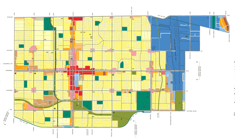
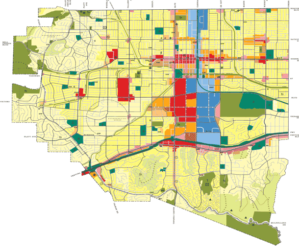
As part of this process, the Department is concurrently updating three plans: Canoga Park – Winnetka – Woodland Hills – West Hills, Encino – Tarzana, and Reseda – West Van Nuys - Lake Balboa. These three documents are the Southwest Valley Plans.

The Department’s aim is to engage the community around two key goals: planning for projected population and employment growth in the Southwest Valley over the next 25 years in an inclusive, equitable, sustainable and healthy manner, and applying the City’s new Zoning Code structure to the region. Community participation in the plan update will be vital for ensuring that the City’s land use policy accurately reflects the community’s vision for the Southwest Valley.

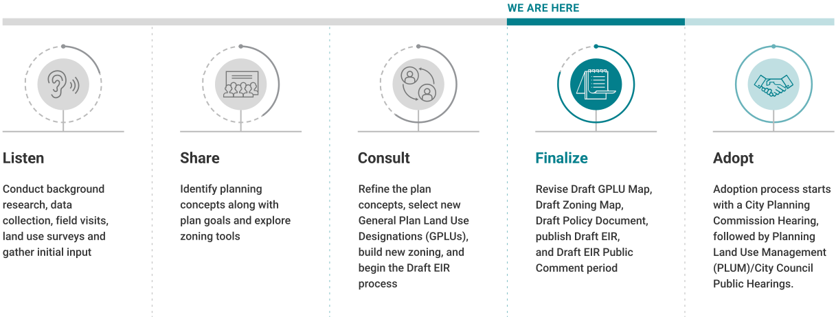
Outreach Timeline


Purpose and Intent

The primary intent of the Ventura/Cahuenga Boulevard Corridor Specific Plan is to assure that an equilibrium is maintained between the transportation infrastructure and land use development within the Corridor. To achieve this, the Plan focuses on providing an effective local circulation system, promoting an attractive pedestrian environment, establishing comprehensive community aesthetics, and assuring a balance of commercial land uses.

History of the Specific Plan

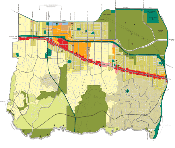
Adopted originally in 1991, the Specific Plan was most recently updated by Ordinance No. 188,816, effective March 14, 2026. The Corridor extends from the Dry Canyon-Calabasas Flood Control Channel west of Woodlake Avenue to just east of Oakcrest Drive. The Specific Plan is divided into six distinct major communities: (1) Cahuenga Pass, (2) Studio City, (3) Sherman Oaks, (4) Encino, (5) Tarzana, and (6) Woodland Hills.

Plan Overview

This web application allows users to view special subareas within the Ventura-Cahuenga Boulevard Corridor Specific Plan including:

  • Pedestrian Oriented Areas,
  • Pedestrian Development Districts, and the
  • Regionally Impacted Area.

The web app also identifies all Housing Element Sites including the Prior Housing Element Sites (ZI 2535) and the Lower Income Rezoning Housing Element Sites (ZI 2534), which allow for Ministerial Approval if certain criteria are met, including within the boundaries of overlays.

Search the web app to learn more about a location and its surrounding area.


Council District(s) Area Planning Commission(s) Community Plan Area(s)
3 and 4 Canoga Park - Winnetka - Woodland Hills - West Hills

Encino – Tarzana

Sherman Oaks - Studio City - Toluca Lake - Cahuenga Pass
 South Valley


Summary

City Planning initiated the Wildlife Pilot Study in 2016 in response to a Motion introduced by City Councilmember Paul Koretz. The Motion called for the Department to create an ordinance with a set of land use regulations that would maintain wildlife connectivity in the City.

Los Angeles benefits from world-class climate, natural spaces, and biodiversity that contribute to residents' quality of life. These important resources are mixed in among the City’s homes, businesses, roads, and other infrastructure. By elevating sustainability in the development process, we can support conservation of local plants and animals while building climate resilience, fire safety, and a healthy watershed.

Please click to view an interactive map of the Wildlife District, the first area in the City where the Wildlife Ordinance is proposed to apply.

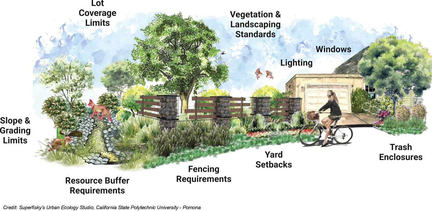
The Wildlife Pilot Study, stakeholder outreach, and expert feedback have informed an approach to proposed regulations for new development within the Wildlife District. These regulations would restrict development in highly vegetated and steeply sloped areas that would result in impacts to wildlife movement and habitats.  Future work programs intend to expand the proposed regulations for the Wildlife District to include the Protection Areas for Wildlife (PAWs) within the City.

Status of the Proposed Wildlife Ordinance

On June 20, 2023, the proposed Wildlife Ordinance was considered by the City Council’s Planning and Land Use Management (PLUM) Committee. The PLUM Committee unanimously voted to approve the proposed Wildlife Ordinance with some additional modifications and directed the City Attorney to review the Wildlife Ordinance for form and legality. On November 7, 2024, the City Attorney’s Office completed their review and transmitted the Wildlife Ordinance back to City Council for consideration. 

The most recent version of the Wildlife Ordinance can be found here.

As instructed by the PLUM Committee, Los Angeles City Planning prepared a Zone Change Ordinance (accompanied by a Technical Corrections Memo) and a report regarding resources needed to implement the Wildlife District and the creation of a list of qualified biologists. City Planning transmitted these documents to the City Council in November 2024.

The City of Los Angeles’ adopted budget for Fiscal Year 2025-2026 includes the elimination of funding for Los Angeles City Planning’s Wildlife Work Program and, therefore, this Work Program will be discontinued. Despite this pause, City Planning remains committed to advancing the City’s sustainability goals to ensure a resilient future and livable city for the people, plants, and wildlife that call Los Angeles home.

To stay apprised of Wildlife Ordinance updates, please subscribe to the Council File, Council File 14-0518.

Proposed Regulations for Wildlife

Proposed Regulations for Wildlife

What is the Housing Element?

The Housing Element of the General Plan, also called "the Plan to House LA," identifies Los Angeles’s housing needs and opportunities and establishes clear goals and objectives to inform future housing decisions. On November 24, 2021, the Los Angeles City Council adopted the 2021-2029 Housing Element. On April 21, 2022, City Planning released proposed targeted amendments to the Housing Element for public comment. Both CPC and PLUM recommended approval by the City Council. On June 14, 2022, the full City Council adopted the targeted amendments. The Housing Element will guide the creation and implementation of the City's housing policy from 2021 to 2029. On June 29, the California Department of Housing and Community Development (HCD) informed the City of Los Angeles that its 2021-2029 Housing Element was in full compliance with State law.

State law requires the City to update its Housing Element every eight years and demonstrate sufficient zoned capacity for housing to accommodate the number of units identified in the Regional Housing Needs Assessment (RHNA). City Planning worked alongside the Los Angeles Housing Department (LAHD, and formerly HCIDLA) on the recently approved update.

For more information, please review the Housing Element FAQ, What Does the Plan Do, and the What to Know about: RHNA, Site Selection, and Rezoning.

Review the Proposed Amendments
 

Review the proposed targeted amendments to the Adopted Housing Element 2021-2029

Read the Plan
 

Click below to read the Plan to House LA.

FAQ
 

Click below for answers to frequently asked questions about the Housing Element update

Timeline + Outreach

Outreach Timeline

2013-2021 Housing Element

The previous 2013-2021 Housing Element set goals to increase housing production and preservation, ensure neighborhood livability, prevent discrimination, and end homelessness. It provided the foundation for the City's progressive programs and initiatives that seek to develop and preserve market-rate and affordable housing. The updated Housing Element presents an opportunity to build on that foundation as Los Angeles continues to address the housing crisis.

Hoja Informativa (Español) 情况说明书 (中文)

City Planning is pleased to announce the Los Angeles City Council voted to approve the Cornfield Arroyo Seco Plan (CASP) Update on October 29, 2024. City Council’s actions and all relevant documents can be found in Council File 13-0078-S2. Next, the approved CASP Update will be reviewed and finalized by the City Attorney in the Form and Legality process, which can take six to nine months.

Previously, the Final EIR was released on July 10th, 2024. More information about the Final EIR can be found here.

On December 14, 2023, the City Planning Commission (CPC) recommended approval of the Cornfield Arroyo Seco Specific Plan (CASP) Update. An audio recording of the CPC meeting can be accessed here, while City Planning’s staff presentation can be found here. The CASP Update is case file number CPC-2021-2642-SP, under Item No. 11 on the CPC meeting agenda. The Staff Recommendation Report and relevant Exhibits considered by the City Planning Commission can be found under Materials.

Interested parties are invited to subscribe to our email list to stay informed about the progress of the CASP Update.

Summary

Los Angeles City Planning is updating the Cornfield Arroyo Seco Specific Plan (CASP) to support the production of more affordable, mixed-income, and permanent supportive housing compared to the existing Plan. Key changes include strengthened affordable housing requirements, the establishment of a new Community Benefits Program, provisions that facilitate new affordable housing projects on public land, an overall increase in housing capacity, and a modernized zoning system based on the City’s new Zoning Code. The updated CASP will support the City’s efforts to accelerate housing production during the housing crisis, while recognizing the diverse needs of the long-standing communities and industries that share this space.

Background

Adopted in 2013, the CASP is a land use document that governs a 600-acre light industrial area in the eastern portion of the City, near the communities of Chinatown, Cypress Park, and Lincoln Heights. The area is interspersed with clusters of residential neighborhoods, commercial uses, City-owned land, affordable housing developments, and open spaces, such as the Los Angeles State Historic Park (also known as the Cornfield). Today, the CASP area is home to about 6,200 residents and there are about 1,800 dwelling units in the CASP, three-quarters of which are in multi-family buildings.

One of the stated goals of the existing CASP is to facilitate the production of more affordable housing for Extremely Low and Very Low Income households. Approximately 48 percent of renter households in the CASP have Extremely Low ($35,750 annual income for a family of four) or Very Low ($59,550 for a family of four) Incomes, compared to 30 percent with the City of Los Angeles as a whole. However, affordable, mixed-income, and permanent supportive housing production within the CASP has been limited. City Planning is updating the CASP’s land use regulations so that they can better advance housing opportunities for all Angelenos.

Key Provisions of the Draft Plan

Released in November 2022, the Draft Plan of the updated CASP introduces new provisions that incentivize on-site affordable housing units, incentivize other community benefits, and improve the clarity and transparency of regulatory standards. The feedback of stakeholder groups, including affordable housing developers, community organizations, and City departments, during the initial outreach process, as well as background research and economic analysis, informed these proposed changes.
Update Components:
  • A new Community Benefits Program;
  • Facilitating new affordable housing projects, including on public land;
  • An increase in housing capacity; and
  • A modernized zoning system based on the City’s new Zoning Code.

For more information, see CASP Update Fact Sheet & FAQ (Fall 2023).

Public Engagement Opportunities
 

Sign up for updates on the CASP Update and attend outreach events!

Subscribe to About