West Los Angeles Community Plan

Staff Contact: Project Review
Julissa Lopez-Hodoyan (213)978-1172
julissa.lopez-hodoyan@lacity.org
Staff Contact: Plan Policies

Nick Vasuthasawat (213) 978-1250
nick.vasuthasawat@lacity.org

General Information:

West Los Angeles Public Counter: (310) 231-2598

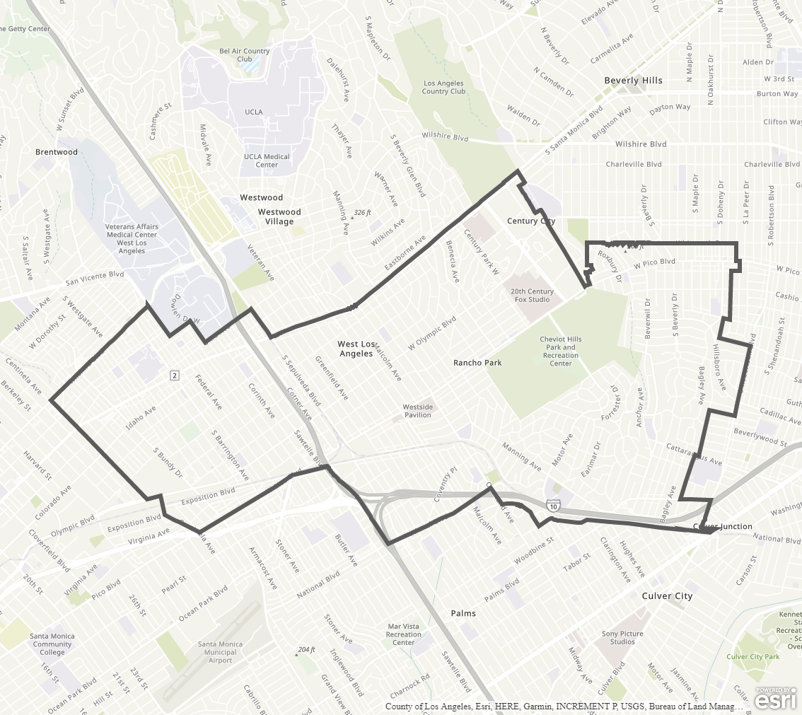
Community Plan Boundary Map


The West Los Angeles Community Plan currently in effect was adopted in 1997. A community plan update process is actively underway; please see above for link and information on current status and how to get involved.

The Community Plan area includes the neighborhoods of West Los Angeles, Century City, Pico-Robertson, Cheviot Hills, Rancho Park, and Sawtelle.

  • Community Plan Document

Adopted Maps

These maps represent official documents that were approved by the City Council. These commonly show land and development rules and regulations by graphic representation.

  • General Plan Land Use
  • Circulation

Interactive Maps

These maps have multiple layers that can be selected to show resources, landmarks, government faculties and services, and other information that is pulled from multiple sources.

  • Interactive Maps

Informational Maps

These maps are for informational purposes only.

  • Economic Development Areas
  • Commercial and Industrial Zones
  • Generalized General Plan Land Use
  • Specific Plan Areas
  • Generalized Zoning
  • Century City North (Specific Plan)
  • Century City South (Specific Plan)
  • Exposition Corridor Transit Neighborhood Plan
  • Livable Boulevards (Streetscape Plan)
  • Sepulveda Corridor (Specific Plan)
  • West Los Angeles Transportation Improvement and Mitigation Specific Plan (Specific Plan)
  • West Wilshire Boulevard (Community Design Overlay)
  • Westwood - Pico NOD (Pedestrian Oriented District/Neighborhood Oriented District)